2110.1 Eastern English Channel - 1:600,000 WGS 84
2110.2 Dover Strait - 1: 200,000 WGS 84
2110.3 Cap Gris-Nez to Dieppe - 1:200,000 WGS 84
2110.4 Nieuwpoort & Nord-Pas-de-Calais Plans - Scales: various WGS 84
Plans included:
Nieuwpoort (1:30 000)
Rade de Dunkerque (1:125 000)
Dunkerque (1:25 000)
Calais (1:20 000)
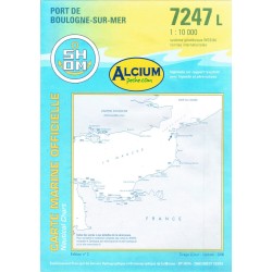
Boulogne-sur-Mer (1:25 000)
Étaples (1:75 000)
2110.5 Dieppe to Le Havre - 1: 200 000 WGS 84
2110.6 Picardy & Upper Normandy Plans - Scales:various WGS 84
Plans included: Baie de Somme (1:75 000)
Le Tréport (1:12 500)
Dieppe (1:12 500)
St-Valéry-en-Caux (1:12 500)
Fécamp (1:12 500)
2110.7 Approaches to Le Havre & River Seine - 1: 60 000 WGS 84
2110.8 River Seine Plans - Scales: various WGS 84
Plans included:
Le Havre (1:12 500)
River Seine to Tancarville (1:63 000)
Honfleur (1:12 500)
2110.9 Baie de Seine (East) - 1: 155 000 WGS 84
2110.10 Baie de Seine (West) to Cherbourg - 1: 155 000 WGS 84
2110.11 Lower Normandy Plans - Scales: various WGS 84
Plans included:
Deauville/Trouville (1:15 000)
Dives-sur-Mer (1:30 000)
Ouistreham (1:25 000)
Courseulles-sur-Mer (1:20 000)
Arromanches (1:35 000)
Port-en-Bessin (1:10 000)
Grandcamp-Maisy (1:6000)
Baie du Grand Vey (1:75 000)
Saint-Vaast-La-Hougue (1:20 000)
Barfleur (1:15 000)
Cherbourg (1:40 000)
Port Chantereyne (Cherbourg) (1:10 000)
Omonville-la-Rogue (1:7000)